Building date: c. 1841, razed (unknown year); replaced by a frame structure.
Original use: Schoolhouse
Corner structures: Rough hewn quoins
Mortar application and content:
Types and uses of stones: Multi-hued, sized and shaped fieldstones
Types and choice of windows: No lintels since window tops were at roof line and narrow wooden sills.
Structures with similar masonry details:
Masons who worked on building:
Unique features:
Map views courtesy Google Maps. Exact location is unknown, approximate given; 43°02'44.83"N 77°02'59.03"W.
Town of Arcadia and Wayne County Maps.
Arcadia Dist 4 Schoolhouse history sheet. From the personal research of cobblestone historian Karen Crandall.
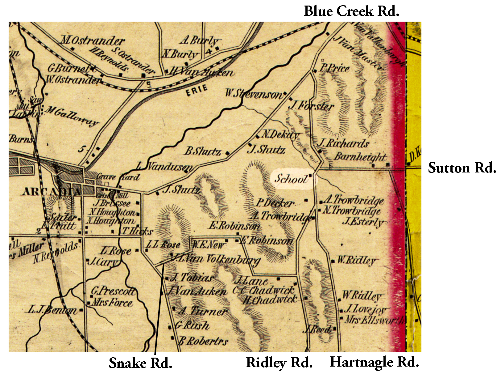 1853 Wayne County Map Arc-14 Excerpt.jpg ¹ | 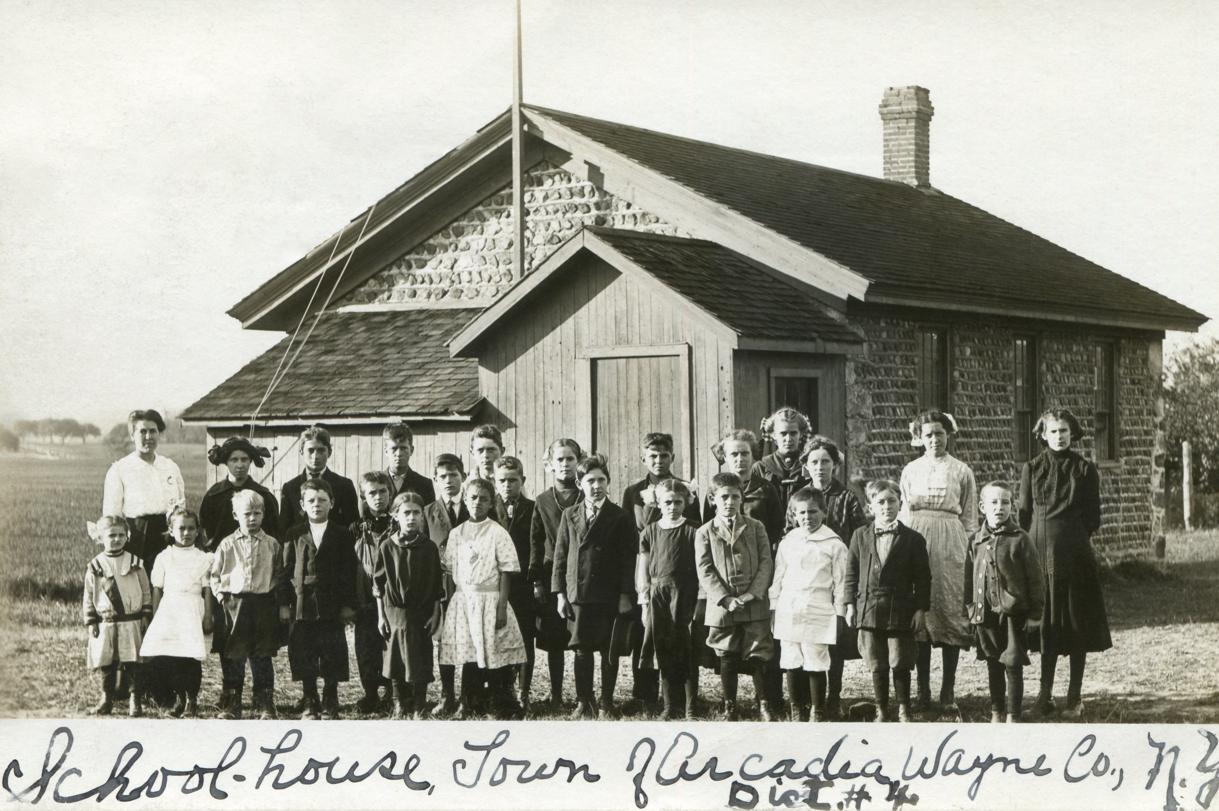 Hartnagle SH 4, photo about 1910.jpg ² Photo about 1910 | 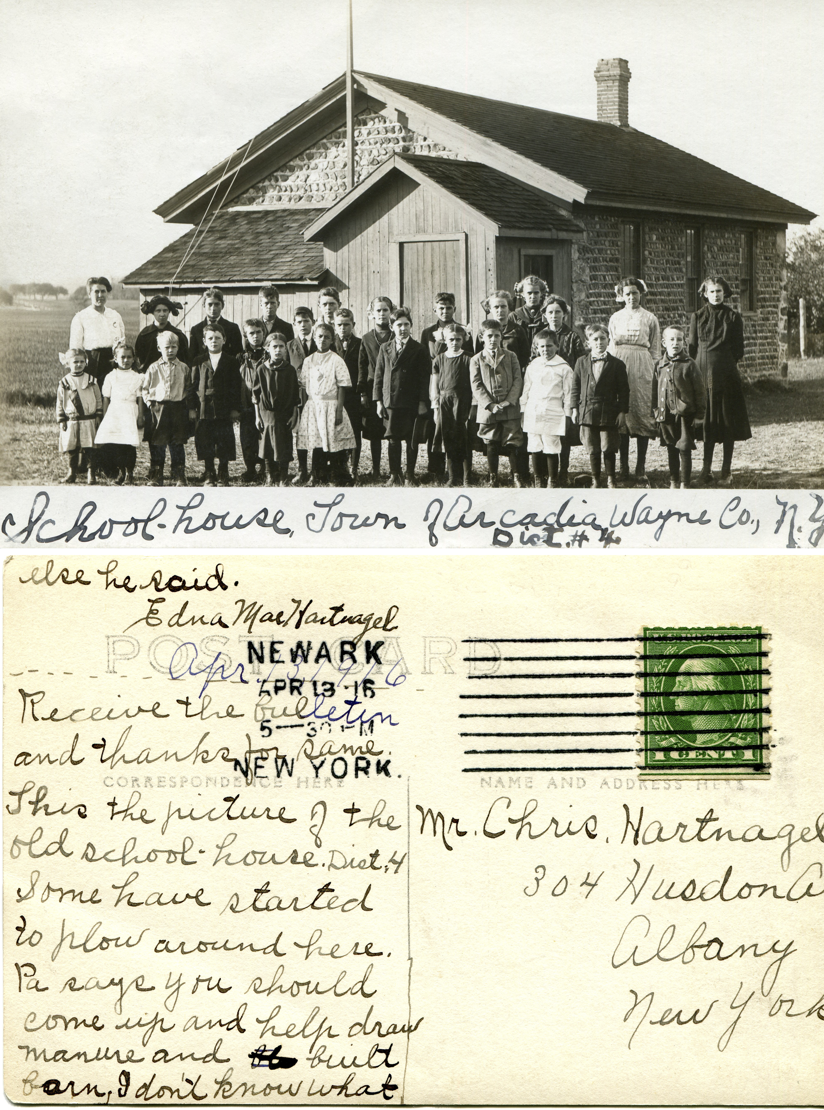 Hartnagle SH 4 photo & postcard.jpg ² Photo about 1910 and postcard dated 4/13/1916. |
¹ 1853 Wayne County Map courtesy Library of Congress.
² Image courtesy Karen Crandall. Picture postcard on file at Newark-Arcadia Historical Society.
